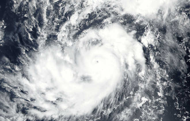
MET Department officials say the weather system is 590 km south east of Chennai and 550 km south east of Puducherry, as seen by 8.30 am today. It is very likely to intensify into a cyclonic storm in the next 24-hours and cross the coast between Karaikal and Mamallapuram near Chennai on Wednesday afternoon.
Weather officials say it will emerge as a severe cyclone during its landfall triggering a wind speed of 100 to 110 km an hour gushing to 120 km per hour. Fishermen have been asked not to venture into the sea during the period.
The National Disaster Response Force NDRF has dispatched from its Arakkonam Base near Chennai, six teams of twenty personnel each to Cuddalore ahead of the cyclone’s landfall. They will assist the administration in carrying out cyclone mitigation efforts, as the district is prone to natural calamities.
All the district administrations in the vicinity of the potential cyclone have been ed to take precautionary measures for the safety of the public. Thousands of first responders and multi-departmental teams are keeping close watch on the vulnerable areas. As the rain activity is expected to gather momentum from tomorrow, shelters have been established to accommodate people living in low lying areas.
By Tapas Bhattacharya