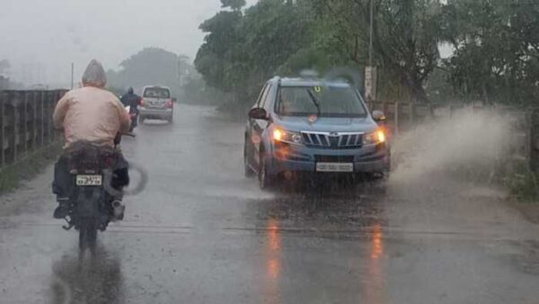
According to the National Weather Forecasting Centre of the India Meteorological Department (IMD):
(Monday 07 June 2021, MID-DAY, Time of Issue: 1245 hours IST)
ALL INDIA WEATHER SUMMARY AND FORECAST BULLETIN
Significant Weather Features
- The Northern Limit of Monsoon (NLM) continues to pass through lat. 18.0°N/ Long. 65°E, lat. 18.5°N/ Long. 70°E, Alibagh, Pune, Medak, Nalgonda, Rentachintala, Sriharikota , 14°N/ Long. 85.0°E, 16°N/88°E, 20°N/90.5°E and 24.0°N/89.5°E and Bagdogra.
- A Low Pressure Area is likely to form over North Bay of Bengal & neighbourhood around 11th June, 2021. Under its Influence, Southwest Monsoon is likely to advance into most parts of Odisha, West Bengal and Jharkhand and some parts of Bihar during subsequent 2
- Under the influence of likely formation of Low Pressure area over North Bay of Bengal & neighbourhood:
- Fairly widespread to widespread rainfall activity very likely over most parts of East India and adjoining Central India from 10th June Isolated heavy to very heavy rainfall very likely over Odisha during 08th-11th; over Gangetic West Bengal on 10th & 11th; over Jharkhand on 11th and over East Madhya Pradesh, Vidarbha, Chhattisgarh on 10th & 11th. Isolated extremely heavy falls also very likely over Odisha on 11th June, 2021.
- Enhanced rainfall activity likely along the West coast including
- Due to strengthening of southwesterly winds and other favourable meteorological conditions; fairly widespread to widespread rainfall activity very likely over Northeastern state during next 4-5 days. Isolated heavy rainfall very likely over Arunachal Pradesh on 07th & 08th; over Assam & Meghalaya during 07th-10th; over Sub-Himalayan West Bengal & Sikkim during 07th-09h; over Nagaland, Manipur, Mizoram & Tripura on 07th & 08th June.
- Under the influence of the off-shore trough at mean sea level from north Maharashtra coast to north Kerala coast; isolated to fairly widespread rainfall accompanied with thunderstorm and lightning very likely over parts of south peninsular India during next 4-5
- Dust raising strong surface winds (30-40 kmph) very likely to prevail over plains of Northwest India during 08th-10th
(Please CLICK HERE for more details & graphics)
Kindly download MAUSAM APP for location specific forecast & warning, MEGHDOOT APP for Agromet advisory and DAMINI APP for Lightning Warning & visit state MC/RMC websites for district wise warning.

